21 Apr Telluride Institute News: Community Mapping Project
You are cordially invited to a presentation on mapping and the launch of a Community Mapping Project by Dan Collins on Monday, May 9th, at 6 pm in the Wilkinson Library project room.
Dan is working on a set of maps that fold into the Institute’s ongoing efforts surrounding watershed and environmental education. The central project involves creating an online map of local “artworks” (with the broadest possible interpretation of what that might involve) and linking it to a webmap that Dan is developing using some interactive mapping software…kinda like Google Earth, only better!
Dan is interested in “participatory maps” of all kinds—that is, maps produced from the grass roots with the active involvement of individuals and community groups. Working from “the bottom up,” he is developing a number of maps that try to reveal “the hidden dimensions of place.” While any map is valuable, most maps serve to reinforce the status quo. How often do we get the chance to see a map that shows what people themselves think about, create, or experience in a particular place?
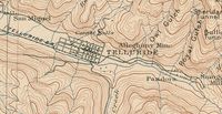
Dan will be presenting his recent work with digital mapping in the context of a discussion about the history of mapping in Telluride. Using maps graciously loaned by local collectors, the Telluride Historical Museum, and the Wilkinson Library, he will provide a background to current practice by giving a examples of how mapping has informed our understanding of the San Miguel River watershed for over 150 years.
Finally, Dan is asking for your help. He needs your ideas about what makes this place special in order to create an alternative map—or maps—of the region. Come prepared to help Dan locate some of those charged sites on a map conceived and designed by the community. There is a chance that the work you do may find its way onto a new “cultural layer” that Dan is developing for the San Miguel County GIS (geographic information system), or the “Atlas of the San Miguel” exhibition at the Ah Haa School in August 2011.
What: Community Mapping Project
Where: Program Room, Telluride Wilkinson Library, 100 W. Pacific Avenue, Telluride, Colorado
When: Monday evening, May 9th, at 6 pm.
For further information, contact Dan Collins: dan.collins@asu.edu


Sorry, the comment form is closed at this time.