
30 Apr Pryor Engagement: Guatemala
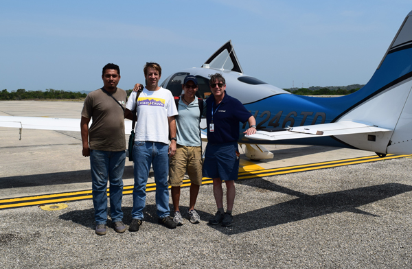
Telluride local John Pryor is executive director of LightHawk, the nonprofit dedicated to accelerating conservation success through the powerful perspective of flight. Since his tenure with the company is relatively short – he Joined LightHawk just a year ago – John went on a very exciting expedition to Central America and Mexico, using his Cirrus SR22 airplane as a way to explore landscapes, partnerships, and conservation opportunities in the region.
This is the fourth and final update from the Rockies to Reef Expedition featuring John and Mesoamerica program manager Armando Ubeda…
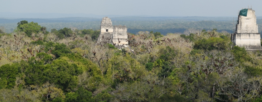
Mayan temples peek through the dense jungles at Tikal, Guatemala. image: Armando Ubeda/LightHawk
Departing Belize City bound for Flores, Guatemala, the aviation gods smiled on John and Armando with clear skies and uncomplicated departure procedures. 45 minutes later they arrived in Santa Elena, Guatemala just before sunset.
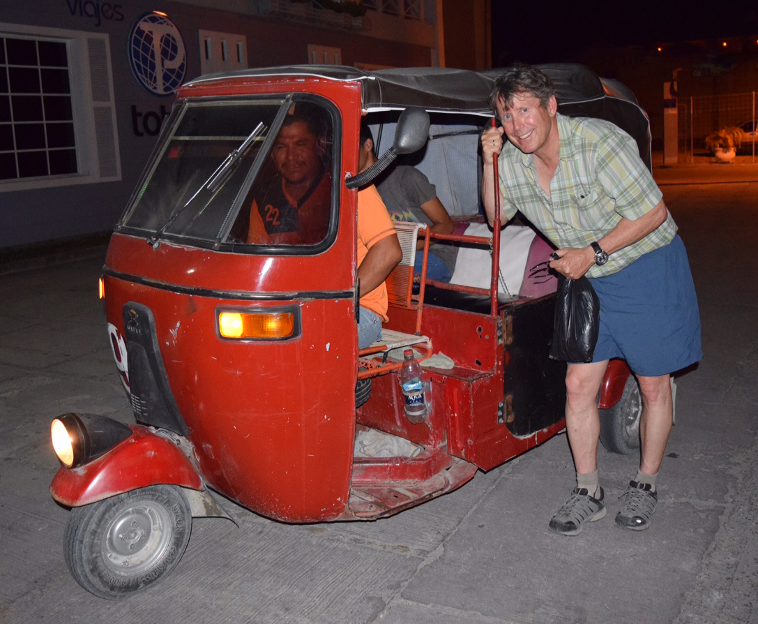
John and Armando take a ‘toot-toot’ back to the hotel. image: Armando Ubeda/LightHawk
As we landed in Guatemala, I was looking forward to learning more about what LightHawk has been able to accomplish in 15 years of conservation flying in the country.
Our first morning in Flores, we met with many of the local organizations LightHawk has been supporting for many years. Sitting around the table that morning with us were representatives from Wildlife Conservation Society, Defensores de la Naturaleza, Guatemala’s National Council of Protected Areas (CONAP), Asociación Balam, Guatemala’s Center for Monitoring and Evaluation (CEMEC) and the country’s largest and oldest university, Universidad de San Carlos.
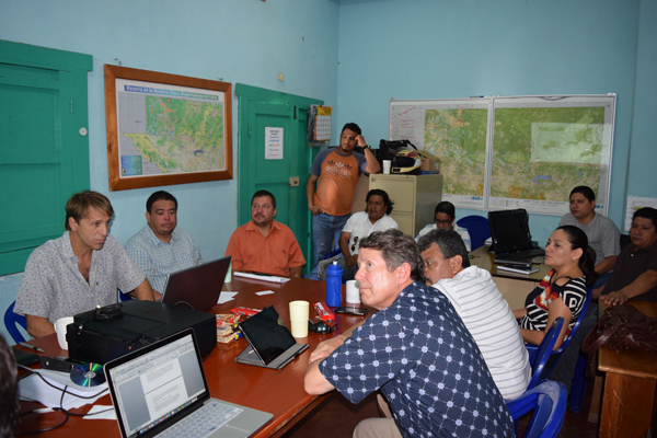
Meeting with partners working on the Maya Biosphere Reserve. image: Armando Ubeda/LightHawk
Later, we were able to visit Tikal National Park with archeologist and park director Jorge Chocón. LightHawk has played a significant role in monitoring the park and the many hectares of surrounding forest for illegal incursions and fire. Flights empower park personnel with information which helps them plan and implement efficient fire prevention programs and protect the forest resources around Tikal, which was one of the most important kingdoms of the ancient Mayans.
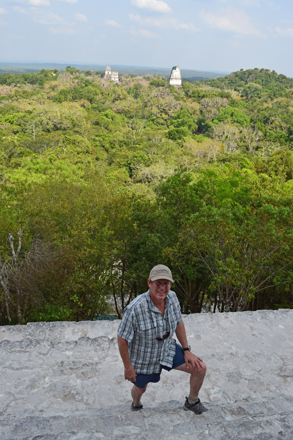
John Pryor atop the highest temple in Tikal. image: Armando Ubeda/LightHawk
LightHawk flights provide valuable information that sheds new light on vulnerable areas of Tikal and the Maya Biosphere Reserve. Viewing the vast expanses of jungle from above has helped put things into perspective, not just identifying current threats, but understanding how to strategize to prevent new hotspots from emerging.
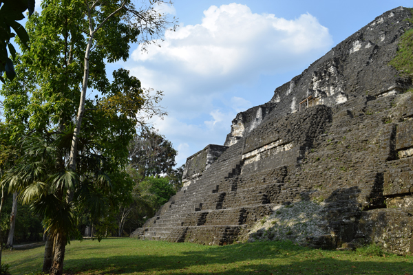
Mayan temple at Tikal. image: Armando Ubeda/LightHawk
“It is hard to explain how satisfying is to be able to help protect not only one of the most important tropical forests in the Americas, but also ancient Maya cities like Tikal, a UNESCO World Heritage Site,” remarked Armando on our way back from Tikal. “LightHawk is doing really amazing work in Latin America, and I am proud to be part of that.”

Vinicio Morales of CONAP, Roan McNab of WCS (in a vintage LightHawk tshirt), Armando and John prepare to fly over the MBR.
After hearing so much about the MBR, I was excited to get back up in the air the next day to enable WCS and CONAP to quickly and comprehensively examine areas where illegal incursions were chipping away at the protected Maya Biosphere Reserve. WCS and CONAP work to safeguard the MBR’s most biodiverse areas by supporting efforts at the national and local level, and working with a range of groups including universities, community leaders, and government agencies.
LightHawk enables radio tracking to monitor collared scarlet macaws above Laguna del Tigre National Park in the Maya Biosphere Reserve. The park contains over 80% of the nesting macaws within Guatemala. image: Asociación Balam/LightHawk
We flew northeast out of Flores with the intention of helping WCS and CONAP to identify and monitor illegal cattle ranching in the protected reserve. Spanning an area larger than Yellowstone National Park, the reserve is lush and green from above. It is heartbreaking to imagine this magical place that is so full of life transformed into dry, barren cattle fields.
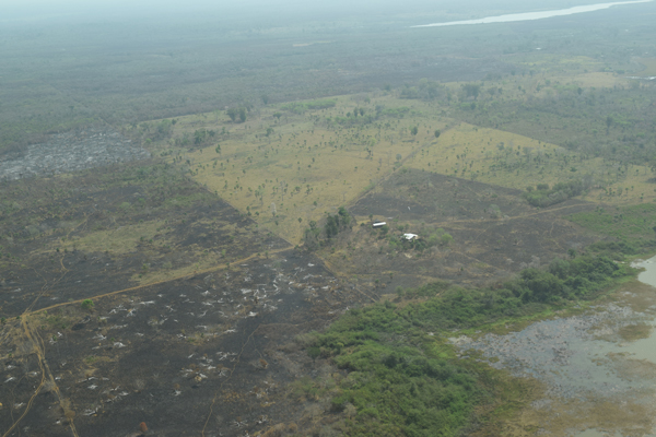
By burning the rainforest, ranchers can grow grass to graze cattle. image: Armando Ubeda
The day before we flew over the MBR, we learned that the government deployed 30 soldiers to evict illegal cattle ranchers. Unfortunately, the troops were surrounded by a hundred farmers who took the soldiers captive for three days. It’s so important that LightHawk provides a safe platform for people like Roan and Vinicio to efficiently gather information to address these important issues facing the Guatemalan rainforests.
On a more positive note, my second LightHawk flight in Guatemala was with Rainforest Alliance’s José Román Carrera and local media to highlight the good work of communities sustainably managing their forest concessions. By responsibly harvesting a portion of selected trees from the forest, they are able to sell certified sustainable wood to local and international markets. The forest concessions not only provide economic benefits to the local communities, they also conserve the forest inside the reserve.
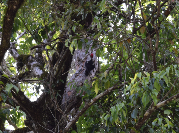
Can you spot the pileated woodpecker? (Dryocopus pileatus) image: Armando Ubeda/LightHawk
Flying over an intact jungle at 1,000AGL for over 3 hours was an experience of a lifetime. It is amazingly beautiful with little sign of man or his influence for much of the time. Occasional ancient temples creeping out of the jungle really punctuated how interesting the area is on many fronts.
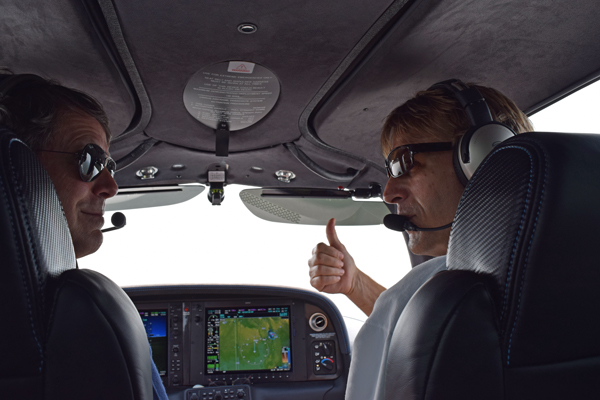
Roan McNab of Wildlife Conservation Society, Guatemala gives Capt. Pryor the thumbs up. image: Armando Ubeda/LightHawk
When Armando and I left Flores, we traveled to Guatemala City to meet with Patricia Orantes, project coordinator of Rainforest Alliance. We talked about the mission we had flown over the MBR showcasing their work with local communities to encourage responsible forestry through concessions and Forest Stewardship Council (FSC) certifications. Patricia also shared a project working with small farmer communities in the western highlands of Guatemala focused on food security and opportunities to obtain economic benefits while protecting and conserving the forest. There are tremendous opportunities for LightHawk to help accelerate this critical work not only in Guatemala, but across the region.
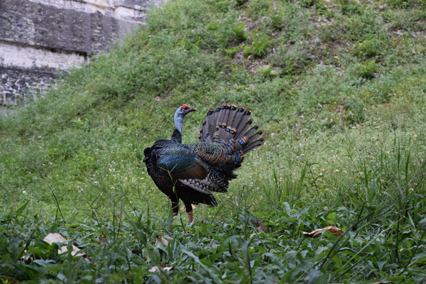
Relative of the wild turkey, the ocellated turkey (Meleagris ocellata) has stunning body feathers in bronze and green iridescent colors. image: Armando Ubeda/LightHawk
We also met with Juan Carlos Godoy a director with The Nature Conservancy, Guatemala. Last year, LightHawk worked with TNC to capture images of communal forest along the volcanic chain of Guatemala. This data was valuable as it allowed for efficient evaluation of the status of forest patches that are extremely important for both water production and storage. TNC also used the aerial images and information to inform decision-making by government and local business to develop effective water conservation strategies.
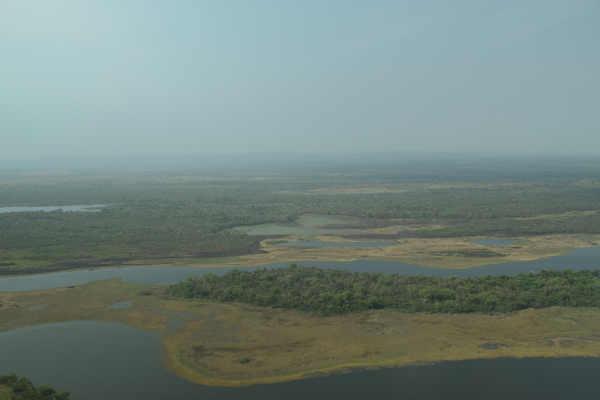
Guatemala hosts La Laguna del Tigre a RAMSAR Wetland of International Importance. image: Armando Ubeda/LightHawk
We talked with Juan Carlos about ways to strengthen and expand our partnership with TNC in Guatemala. I think LightHawk can be a catalyst to support their programs related to climate change, food and water security, and an exciting project that not only conserves the most valuable places, but also creates sustainable economic opportunities for local communities.
We had a terrific meeting with some pilots on the board of directors at the HQ of Aero Club Guatemala. This is the largest pilot organization in the region with over 400 pilots and three separate clubhouses with landing strips. We presented LightHawk’s work to date in the region in which they were very interested. The board members we talked to were excited about the opportunity to support conservation in Guatemala with their flying. “Having pilots already based in Central America will dramatically boost our ability to support conservation here,” remarked Armando after the meeting.
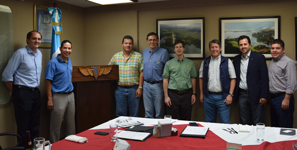
John and Armando meet with the Guatemalan Aero Club leadership
From the Rockies to the Mesoamerican Reef is a long way to fly a small airplane. This was a once-in-alifetime opportunity and an incredibly enriching experience to understand the value LightHawk brings to urgent conservation efforts in Mexico and Central America.
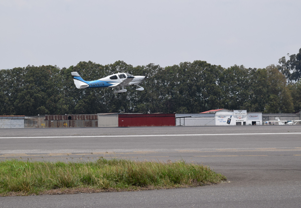
Saying goodbye and departing Guatemala heading north. image: Armando Ubeda/LightHawk
Sorry, the comment form is closed at this time.